


Human editorial review before publication · Member of the Intelligence.Navy Maritime Intelligence Team · 20 Oct 2026 · 21:04 UTC. Incident verification remains separate.
Research context & editorial reviewDated editorial record · checked 2026-10-20T20:23:08Z. This source is not a connected live stream. Subsequent updates may not be captured.
- Event
- 19 Oct 2026 · time not supplied
- Original source published
- 20 Oct 2026 · 14:30 UTC
- Analysis reviewed
- 20 Oct 2026 · 20:50 UTC
- Human review
- 20 Oct 2026 · 21:04 UTC
- Added to portal
- 20 Oct 2026 · 20:23 UTC
- Source check
- Not supplied
External source reporting used in this assessment
Windward · Reported tanker-associated oil slick off Umm Al Quwain
Key judgment
The reported offshore release warrants immediate verification and coordinated coastal preparedness. The decisive issue is whether a continuing source and an updated drift envelope intersect specific operating assets; the public record does not establish shoreline contamination, a port closure or water-supply disruption.
The public alert was published on 20 October at 14:30 UTC and refers to a remote-sensing collection on 19 October.
UAQ IWP is listed as an operating asset, geographically distinct from Hamriyah; its exposure to this slick is not demonstrated.
Oil-spill remote sensing requires interpretation and contemporaneous metocean context; natural SAR look-alikes remain a relevant general validation issue. The sensor used in this case is unverified.
Approximate source-map area: 25.6°, 55.5°. Regional named-place locator for Umm Al Quwain, rounded from the public city reference (25.55333 N, 55.54750 E; https://en.wikipedia.org/wiki/Umm_Al_Quwain). This coastal reference locates the report, NOT the tanker, offshore spill, intake or pollution footprint. The source reports approximately 25 km offshore without a verified bearing or exact fix. Static basemap; not a satellite image of the incident.
Intelligence question & baseline
Does the offshore pollution warning create a defensible basis for near-term coastal action, and which claimed consequences remain unproven?
The lead alert reports a tanker-associated slick and coastal drift forecast. Public asset descriptions must be checked before translating proximity into lost port or water capacity.
Finding beyond the lead source
Corporate asset disclosures separate Hamriyah IWP future capacity from UAQ IWP listed operating capacity. This changes the decision: protect commissioning and marine works at one asset; first establish actual intake-path overlap before inferring a supply threat at the other.[2][3][4]
Decision affected & alternative explanation
Coastal authorities, utility operators and port operators · Prioritise source verification, current asset status and near-field sampling. Prepare proportionate protective options; do not infer a blanket shutdown from a public model forecast.
Alternative explanation · The observed signature may be oil without reaching the named assets, may disperse or shift, or may have a different source; raw imagery and independent observations are needed. A facility may be nearby yet have no active intake exposed.
Revise the judgment when · Revise immediately on dated operator or authority confirmation of source control, a geolocated shoreline or intake detection, an official operational restriction, or new observations that materially change the drift envelope.
What we learned
Corporate asset disclosures separate Hamriyah IWP future capacity from UAQ IWP listed operating capacity. This changes the decision: protect commissioning and marine works at one asset; first establish actual intake-path overlap before inferring a supply threat at the other.
Maritime implication
Prioritise source verification, current asset status and near-field sampling. Prepare proportionate protective options; do not infer a blanket shutdown from a public model forecast.
1. Observation and chronology
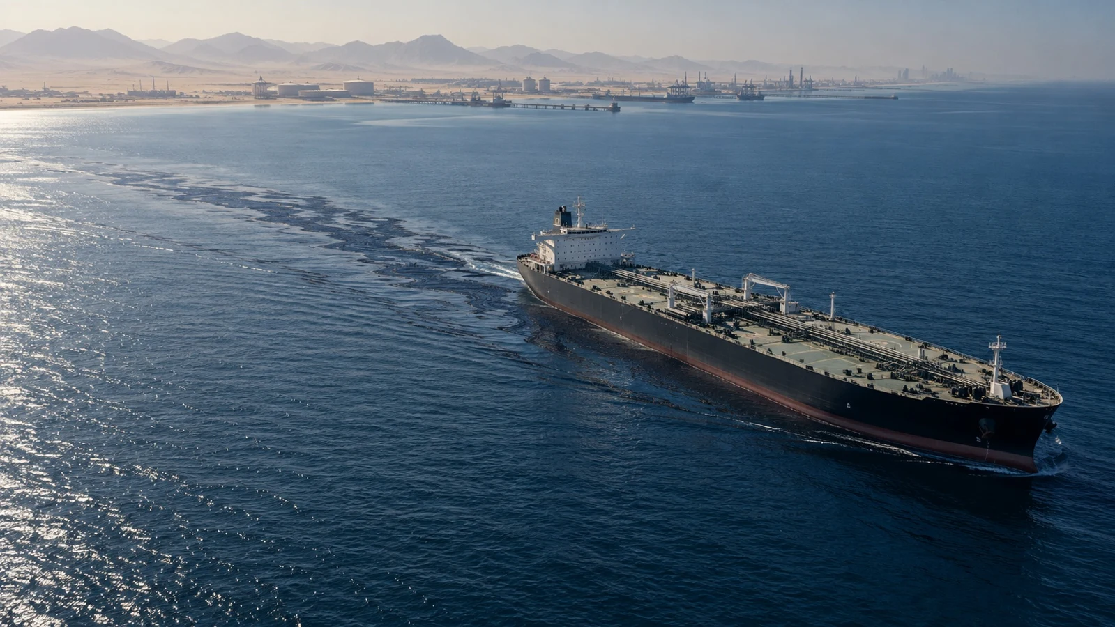
Reported · The originating public account reports a VLCC-size vessel, an approximately 1.5 km slick and a position about 25 km offshore. The vessel is not named. These are attributed source descriptions, not measurements independently reproduced here.[1]
Reported · The published forecast places potential arrival on the UAQ coast on 22 October and movement towards Sharjah and Ajman on 23-24 October. These are model outputs, not observed landfall. Event start, acquisition time of day and model run time were not disclosed.[1]
2. Infrastructure identity and operational state
Analytical inference · Corporate asset disclosures separate Hamriyah IWP future capacity from UAQ IWP listed operating capacity. This changes the decision: protect commissioning and marine works at one asset; first establish actual intake-path overlap before inferring a supply threat at the other.[2][3][4]
Analytical inference · Corporate design capacity must not be summed into water production at risk. First establish the specific intake, operating mode, hydrodynamic connection, water-quality observations and available protective options.[2][3][4]
3. Maritime operations and coastal dependencies
Analytical inference · Hamriyah's industrial and liquid-bulk role makes approach waters, pilotage, tugs and marine works sensible verification priorities. Any operational effect must be evidenced by harbourmaster or operator updates; the warning alone does not show traffic interruption.[1][5]
4. GEOINT validation and collection priorities
Reported · GEOINT access is indirect: this report consulted a public remote-sensing interpretation, not the original georeferenced acquisition. Sensor, resolution, scene time, oil classification and positional uncertainty remain unverified. No independent AIS track or vessel match was established.[1]
Analytical inference · Acquire a new georeferenced observation, cross-check with optical or on-scene evidence where feasible, and update an ensemble drift envelope with current wind and currents. A non-detection must be interpreted against coverage and detection conditions.[6][7]
5. Response decisions and coordination
Analytical inference · Run three linked tracks: identify and verify the source; check the pollutant and its evolution; confirm each receptor's actual status. Environmental authority, harbourmaster and utility decisions require a shared chronology and explicit responsibility for status updates.[1][5][8]
6. Sector and business implications
Analytical inference · A service buyer should test alert-to-decision latency, original data access, reproducibility, update cadence and operator feedback. Detection volume and visually persuasive imagery are insufficient substitutes for validated asset exposure.[1][4][6]
Analytical inference · Satellite suppliers, modelling teams and local response operators provide different parts of the chain. This case does not establish who has commercial access, tasking priority, an awarded response contract or proven incident performance.[1][6][8]
7. HUMINT requirements and source correlation
Reported · No HUMINT was obtained. Priority requests would seek named-role, dated testimony from the master or operator on source control, the harbourmaster on restrictions, and the utility or EPC manager on intake and commissioning status. No person was contacted for this report.[1]
Analytical inference · OSINT asset records and GEOINT-derived reporting support different propositions. Cross-link by time, place, asset and claim, while retaining origin groups. Corporate releases, public posts and professional comments are not confidential human-source reporting.[1][2][3][4]
Business conclusions for maritime intelligence
Analytical inference · For maritime intelligence, value lies in connecting detected pollution, time-stamped vessel identity, forecast uncertainty and asset status. This is a product and procurement implication, not evidence of a contract award, provider performance or sector-wide competitive advantage. [S1-S6][1][4][5][6]
Confidence & evidence limits
MODERATE · Moderate confidence in the need for targeted preparedness and the asset-state distinction; low confidence in actual footprint, vessel attribution and operational impact because the incident observation and forecast share one issuer and raw data are unavailable.
Evidence & analytical reasoning
Reported · The public alert was published on 20 October at 14:30 UTC and refers to a remote-sensing collection on 19 October.[1]
Analytical inference · Hamriyah IWP future delivery dates in the consulted issuer records do not establish a loss of current drinking-water output.[2][3]
Reported · UAQ IWP is listed as an operating asset, geographically distinct from Hamriyah; its exposure to this slick is not demonstrated.[3][4]
Analytical inference · Hamriyah port infrastructure establishes plausible receptors and business dependencies, not actual contamination or a closure.[5]
Reported · Oil-spill remote sensing requires interpretation and contemporaneous metocean context; natural SAR look-alikes remain a relevant general validation issue. The sensor used in this case is unverified.[6][7]
Analytical inference · A continuing release would require rolling source and receptor checks rather than treating one forecast arrival date as the end of the event.[1][6]
Analytical inference · Evidence collection should join the source, spill and asset-status tracks; no direct human testimony or independent scene acquisition was obtained for this report.[1][2][4][6]
Analytical inference · Provider-post repetition across LinkedIn and X is distribution of one analytical account, not independent confirmation.[1]
Next decision indicators
- Source: obtain vessel identity and a dated operator statement confirming whether discharge has stopped.
- Observation: obtain a second georeferenced scene or a dated on-scene report distinguishing oil from look-alikes.
- Forecast: obtain current model run, forcing data and uncertainty envelope; re-evaluate each named coastal receptor.
- Assets: seek operator confirmation of intake position, operating/commissioning state, water-quality measurements and any restriction.
- Escalation: dated verified coastal contact, persistent release or an actual operational restriction changes preparedness into an impact-response assessment.
- De-escalation: verified source control plus repeated adequate-coverage observations outside receptor pathways supports narrowing the watch; one non-detection alone does not.
Publication history · 4 captured versions
Loading captured versions…
Evidence & references
- [1] Windward public remote-sensing and drift alert, 20 October 2026Source account
- [2] ACWA and SEWA: Hamriyah IWP agreement, 4 September 2024Context reference
- [3] ACWA 2025 year-end Investor Report, portfolio tables pp. 24 and 33Context reference
- [4] ACWA: Umm Al Quwain IWP project profileContext reference
- [5] Sharjah Ports: official port and terminal profilesContext reference
- [6] ESA Knowledge Hub: Oil Spill MonitoringContext reference
- [7] ESA Living Planet Symposium: SAR oil-spill look-alikesContext reference
- [8] ITOPF TIP 10: Leadership, command and management of oil spillsContext reference
Evidence scope & unresolved questions
- Vessel identity, IMO/MMSI, cargo, pollutant type, release rate, first release time and whether the source remains active are unresolved.
- Exact acquisition coordinates, sensor, scene time and current spill geometry were not obtained; no independent scene validation was performed.
- Forecast run time, metocean inputs, ensemble spread, coast-contact probabilities and response assumptions are unavailable.
- No dated confirmation of shoreline or intake contamination, water-supply interruption, port closure or deployed response was found in the searches performed. Search absence is not proof of no impact.
- Hamriyah IWP commissioning status on 20 October and the current output of other plants were not verified with operators.
- No direct human testimony was obtained; no link to a named tanker attack or other regional slick is established.
AI-assisted research, followed by recorded human editorial approval. Approval is not independent verification of the incident.. AI-assisted synthesis with recorded human editorial review; event verification remains limited by the attached sources.
Location basis: Regional named-place locator for Umm Al Quwain, rounded from the public city reference (25.55333 N, 55.54750 E; https://en.wikipedia.org/wiki/Umm_Al_Quwain). This coastal reference locates the report, NOT the tanker, offshore spill, intake or pollution footprint. The source reports approximately 25 km offshore without a verified bearing or exact fix.
Windward public remote-sensing and drift alert, 20 October 2026: Full public post and structured publication timestamp retrieved through its public HTML. Raw acquisition, sensor details, model inputs and independent validation were not available.
ACWA and SEWA: Hamriyah IWP agreement, 4 September 2024: Indexed excerpt; live page content was not verified. Official release text available through the search index; live extraction was incomplete. Future dates are a published baseline, not a verified 20 October construction or commissioning status.
ACWA 2025 year-end Investor Report, portfolio tables pp. 24 and 33: Official PDF text inspected. Portfolio is dated 31 December 2025 and cannot establish site status, production or intake condition on 20 October 2026.
ACWA: Umm Al Quwain IWP project profile: Current project profile is undated. It establishes asset identity and listed design capacity, not current output or intersection with this spill.
Sharjah Ports: official port and terminal profiles: Indexed excerpt; live page content was not verified. Official Arabic profile retrieved through indexed text. Static asset description; no current closure, contamination or response deployment verified.
ESA Knowledge Hub: Oil Spill Monitoring: This document provides background or asset information; it does not independently confirm the October spill.
ESA Living Planet Symposium: SAR oil-spill look-alikes: Indexed excerpt; live page content was not verified. ESA-hosted conference material consulted as indexed technical background; this is not a classification or validation of the 19 October observation.
ITOPF TIP 10: Leadership, command and management of oil spills: Publication landing page consulted; no ITOPF participation in this incident is established, and the full TIP was not used for incident-specific claims.